July 22nd, 2023
I met Chris in Placerville, and we carpooled up to Ebbett’s Pass, arriving around 7:30AM. Instead of going all the way to the pass, we parked a few turns east of it, at the Noble Lake Trailhead. We knew it was going to be somewhat hot, and definitely a struggle to get up based on what we had read about this route. Silver Peak is also an interesting Ogul peak in that the slightly lower southwest summit is the Ogul Peak, but not the high point.
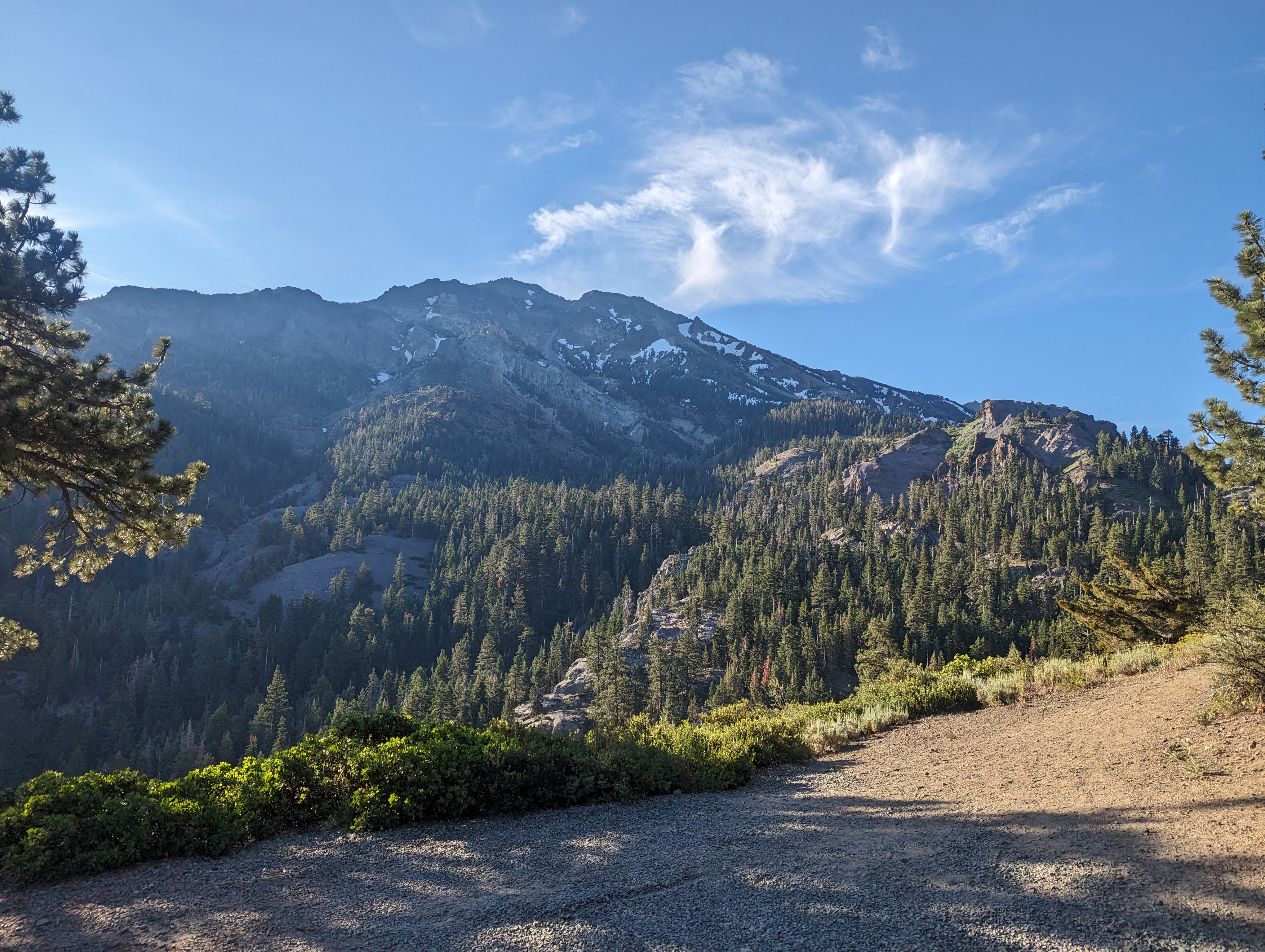 Silver Peak from the Trailhead
We got started and the first few miles of the trail were pretty pleasant. Nicely forested, and mostly flat. After a mile or 2, we came across a pretty massive avalanche path that had created a huge mess of a stand of trees. Considering the size of the trees it knocked over, this seemed to be a fairly rarely powerful avalanche for the area. We navigated our way through the carnage, and soon were at Noble Creek, which we forded with our shoes off.
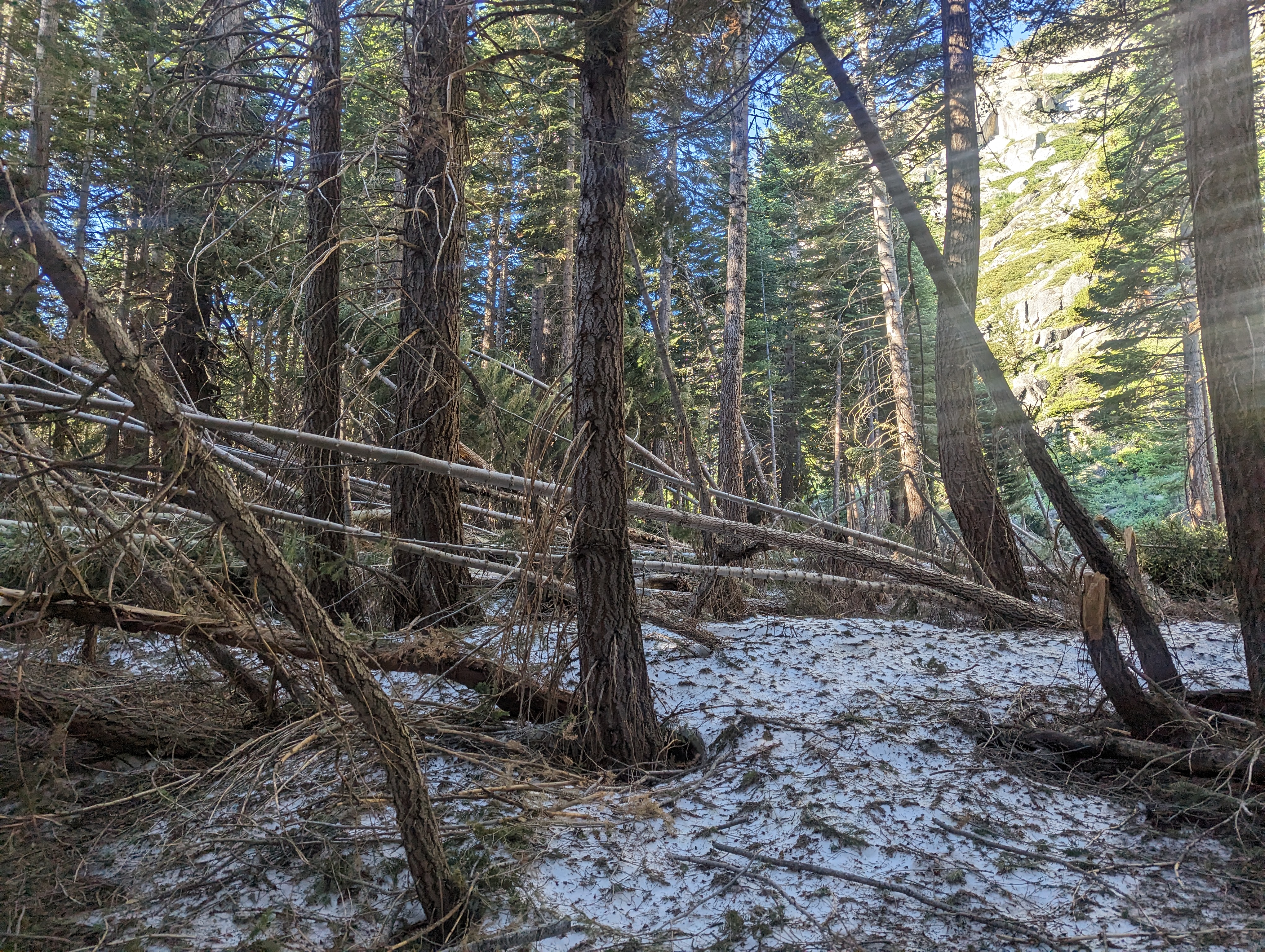 Avalanche destruction
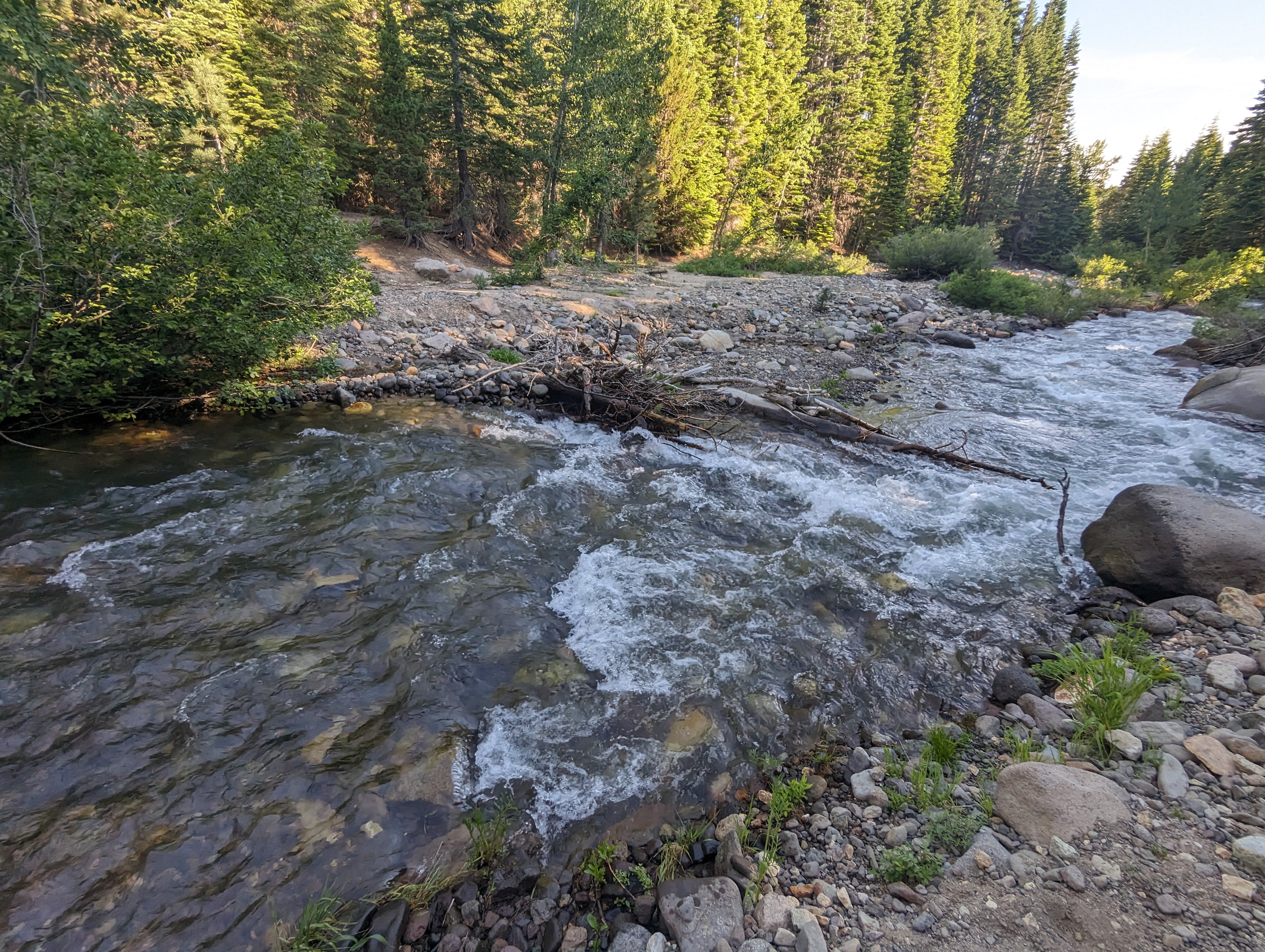 Creek Crossing
Beyond the Creek, we walked perhaps another mile or so, before deciding to start cutting up towards Silver Peak off the trail. I don’t know if we picked a very good spot (it seems like a pretty inhospitable ridge in general), but we were struggling up chossy steep slopes in no time. At a certain point, the choss gave way to bushwhacking for a few hundred yards, accompanied by a healthy population of mosquitos. Chris very much was ready to bail at this point (he hates mosquitos, and they seem to love him), but I managed to convince him to give it some more time. We eventually got above the bushwhack, and made our way into a snow filled drainage. This made things marginally easier, as the snow surface was pretty consistent and firm still. We managed to gain a few thousand feet up this drainage before finally leaving it and cutting over to talus higher up.
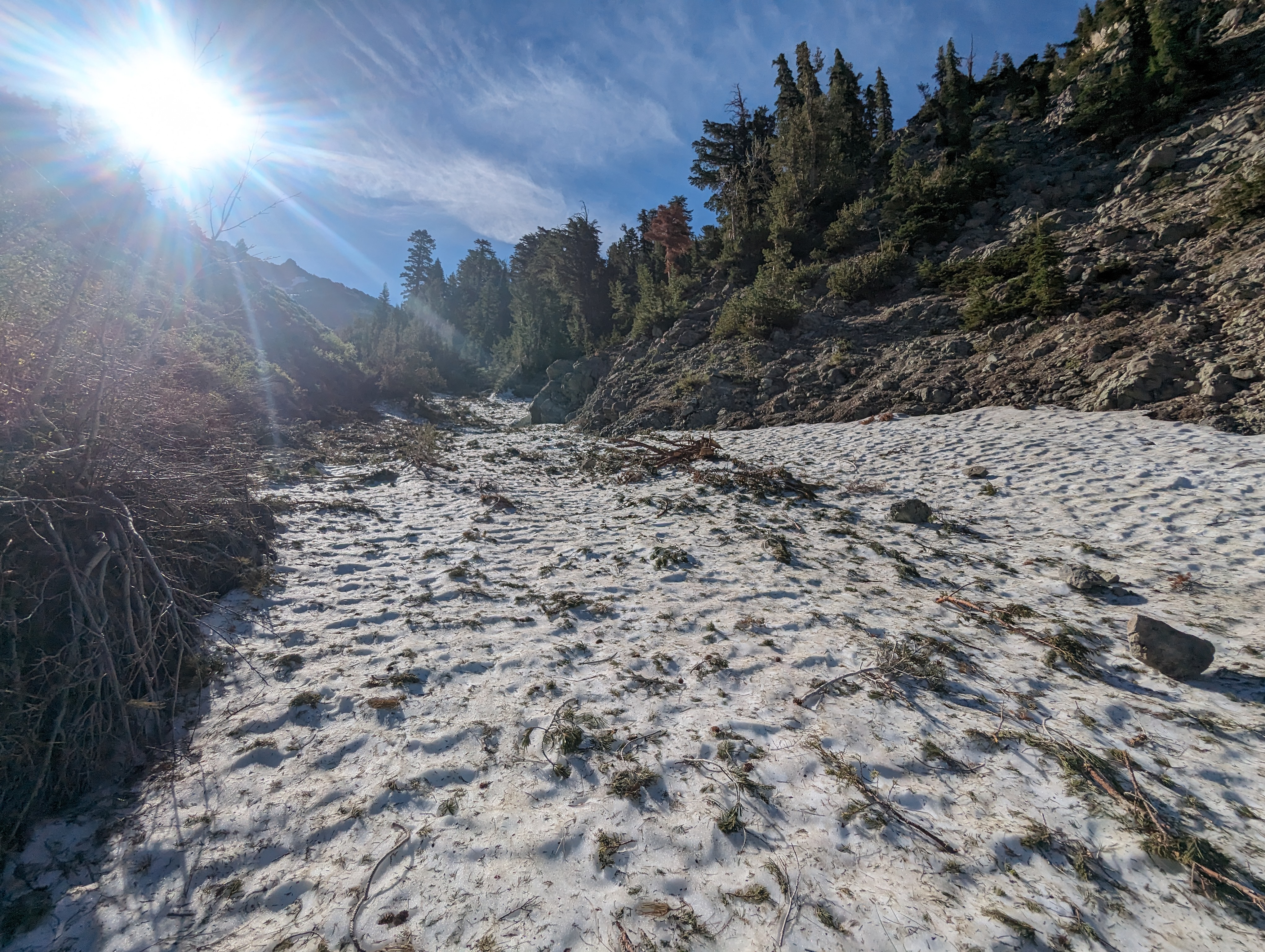 Snow filed drainage we followed up
 Further up the drainage
 Switching over to talus
The talus was probably the easiest surface we had walked on in hours, and we made pretty good time up it. Before long, we could see the 2 summits of Silver Peak. We made it up to the low point in the ridge between the 2, and decided to head for the lower of the 2, the southeast summit, first. This one somehow beat out the Northwest summit for the Ogul list, I’m not sure why as its clearly lower. We hung out for a bit on the summit, and ate some lunch and checked out the contents of the register. There was a huge clump of old wet registers, as well as some weed that someone left in the register (its probably unwise to use random summit register drugs, but thats a personal choice).
 At the saddle just north of the southwest summit
 Summit Panorama
We eventually made our way back down to the saddle, and stopped for a bit there to refill our water from the snowfield there. I had somewhat underestimated the heat, and amount of water I’d need, so I was thankful for the big snow year. We then made our way to the proper summit, took in the views, signed the register, and were back off towards the trailhead.
 Looking towards the NE summit
 NE proper summit panorama
 Chis on the summit
We opted for a slightly more northern route this time, we could see some more open rolling terrain in that direction that looked a lot more friendly than the way we had come up. Getting to that more gentle terrain didn’t come cheap though. We navigated down through a whole plethora of conditions. Extremely steep and deep snow, hazardously loose and steep rock, random clumps of thick forest, this descent had it all. It was a struggle the whole way down, but we managed to have a good time and laugh a bit at how bad the conditions were.
 We aimed for the half moon shaped moraine
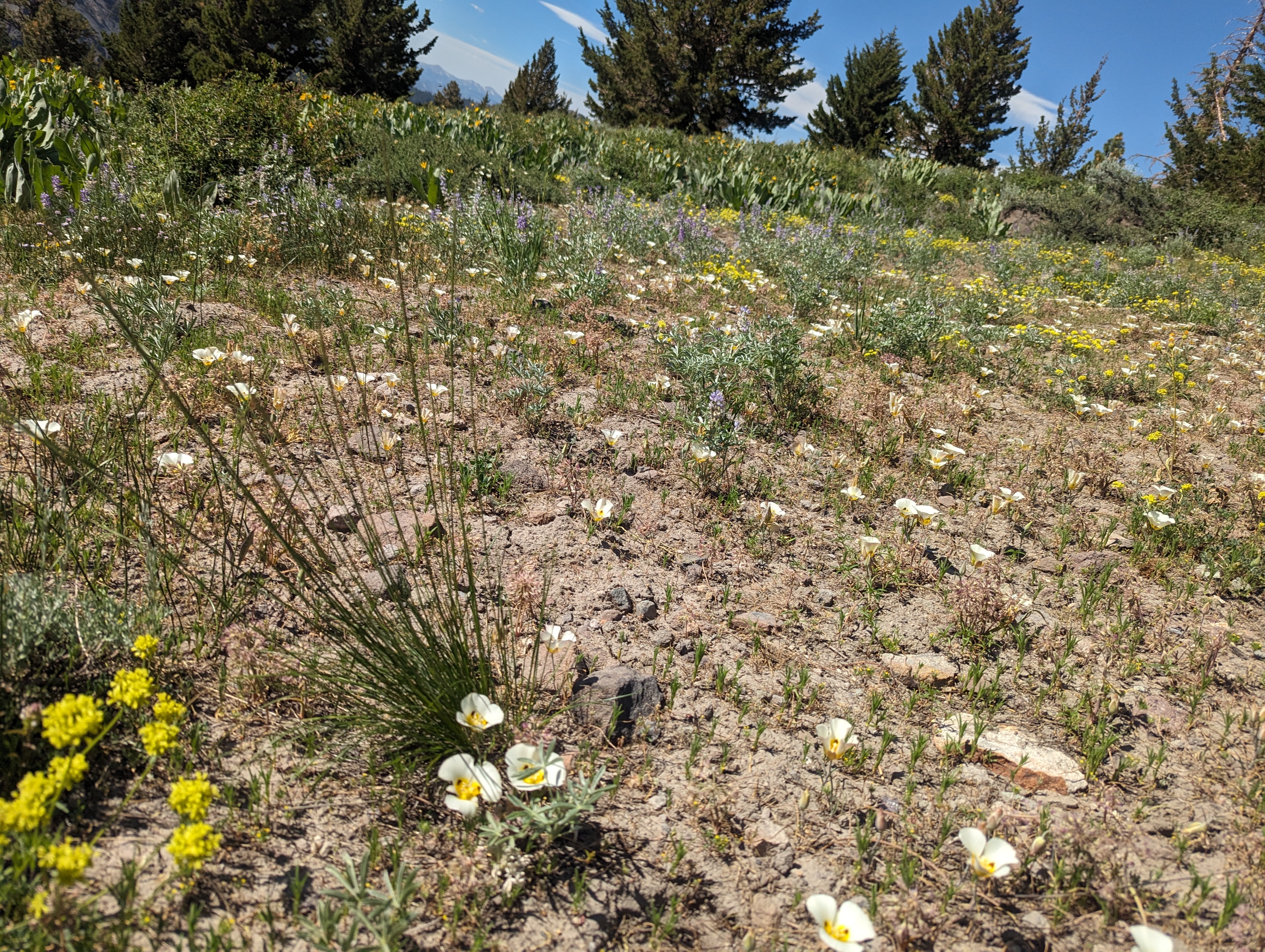 Wildflowers lower down
Eventually we made it down to the more open terrain we had spotted from above, and enjoyed a nice stretch of fairly easy walking. At this point, we were a few hundred feet above the floor of Noble Canyon, but the bottom of the slope was going to be tricky. The slope dropped off dramatically, and was entirely covered in small loose volcanic rock, on top of extremely hard packed (and steep) terrain. We slowly picked a route through the volcanic choss pile, and ended up back on the trail a bit closer to the trailhead than where we had diverted from it that morning. We enjoyed the easy trail walk back to the car, and were back by around 4:45 PM.
Route
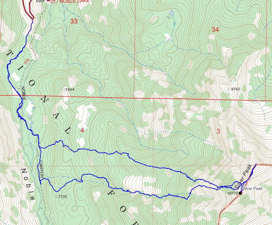 My route
GPX Track Download
My route
GPX Track Download