July 4th, 2024
We woke up after a night of little sleep, we forgot our dog’s bed, so he was restlessly walking around the truck bed all night. Despite being tired, we woke up and cooked breakfast and made coffee so that we could get an early start on the day. After breakfast, we broke everything down and set off down the dirt road back to highway 49. The road out from the trailhead isn’t bad, but has enough ruts and rocks to be a bit slow going. Little did I know that this was just a small sample of what was in store for the day.
Google Maps led us back up 89 through the town of Greagle. I had been just south of Greagle a few months prior to climb Mt Elwell, but had never seen the town itself. The town is quite nice, nestled in a large green valley east of the crest of the Northern Sierra, and seemingly with an economy mostly fueled by golf. We then went through the Plumas-Eureka State Park, which then led to a dirt road. I was a bit confused, as Google Maps showed it taking another hour to go 14 miles. The reason for this became apparent quickly as we slowly made our way up the bumpy, rocky road. The going was quite slow, I think I might have been able to use third gear in my truck one or 2 times on the way. Finally, we arrived at the saddle between Mt Fillmore and Mt Etna, where I planned to start the hike.
 George leading the way up the dirt road, Mt Fillmore in the distance
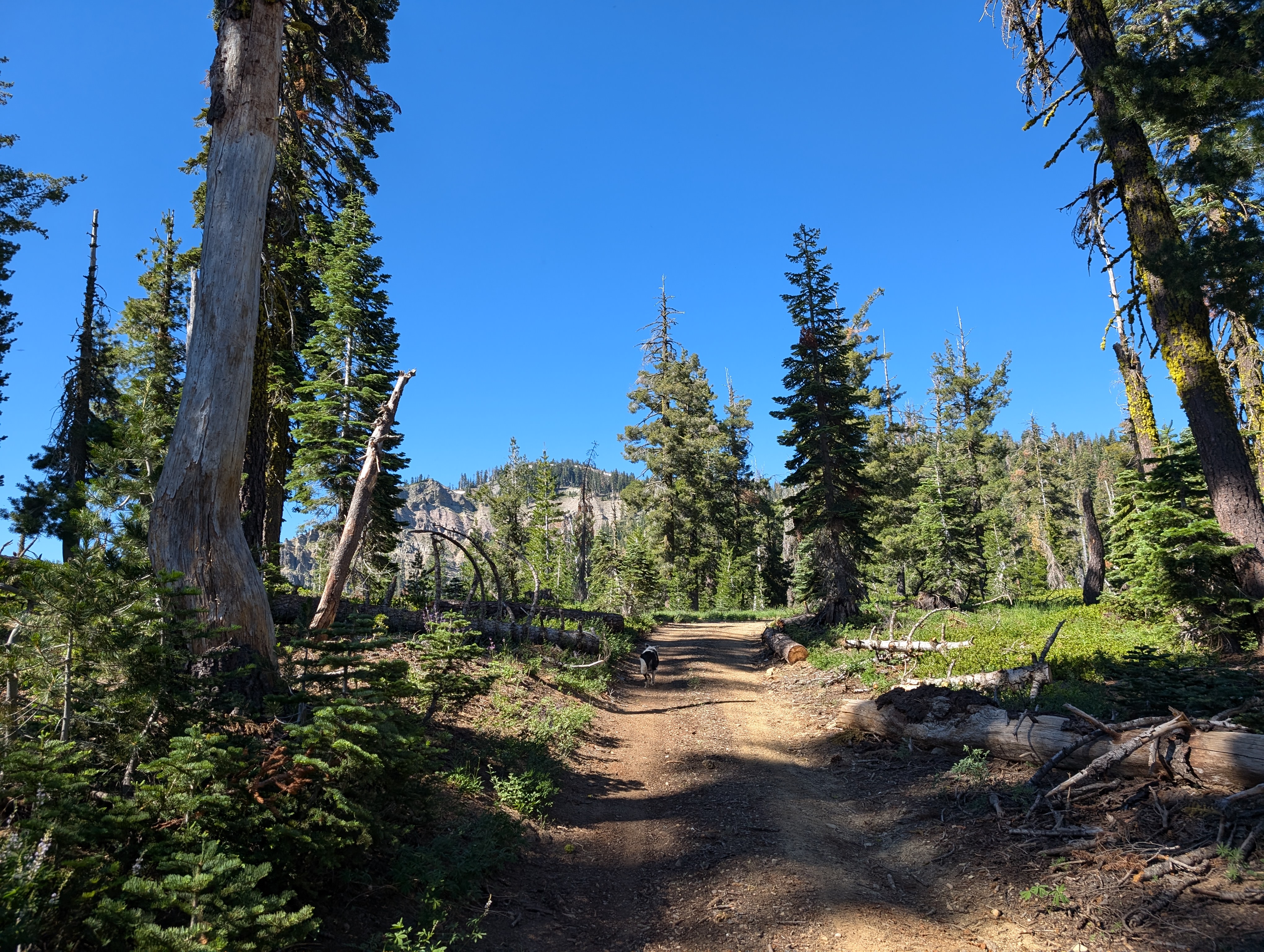
I confused the info I had gotten about this peak with that of Haskell, and was expecting to find a nice trail that we could follow. This proved true for perhaps a half mile, as we followed an old forest service road southwest towards the peak. From there, it became apparent as I checked my map that there was no trail leading to the summit - at least not a mapped one. We cut up into the forest towards the south ridge of Fillmore.
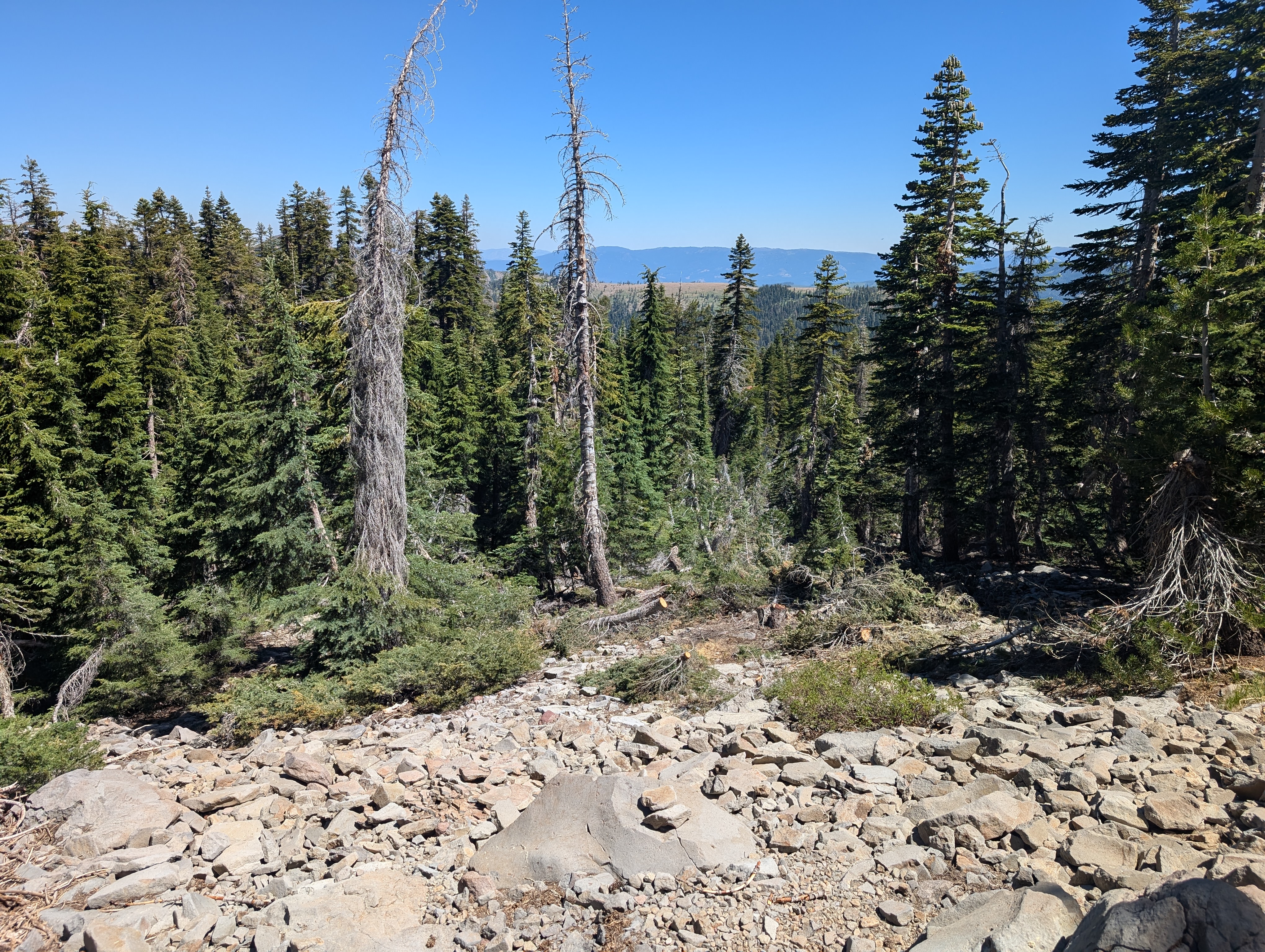
 On the south ridge
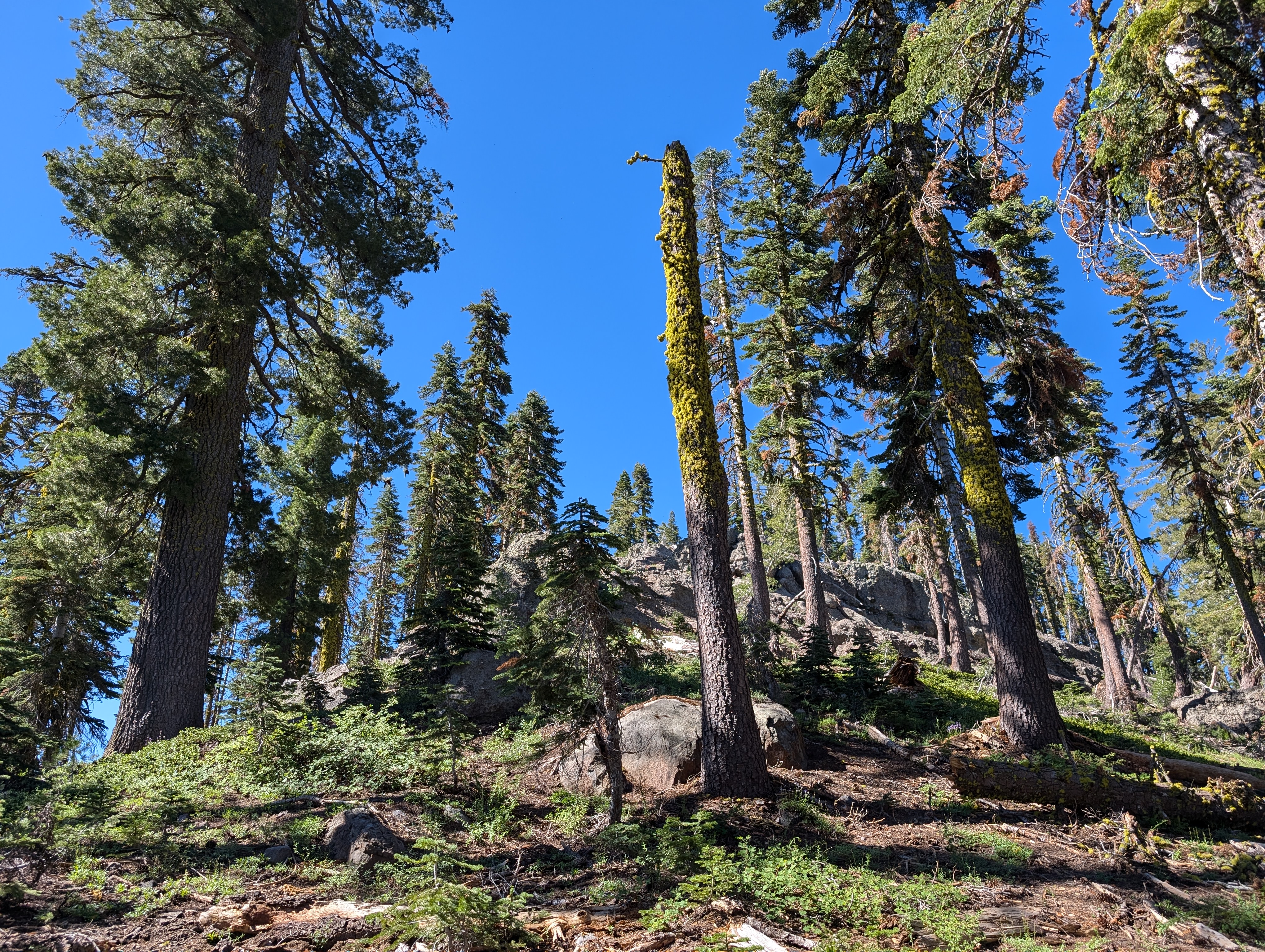
I did my best to avoid too much bushwhacking, as neither my wife nor my dog had signed up for that. We did alright, but there definitely were some small bushes to whack. We soon arrived on the ridge proper, where we picked up a faint use trail that we would use on and off for a bit. The going was pretty easy, and the view soon opened up to the south, where we got a fantastic vantage of the Sierra Buttes.
 The Sierra Buttes in the distance
From there, we cut towards the west so that we could avoid the steep slopes ahead, and take the more mellow western ridge up to the summit. We crossed some nice forest, complete with some snow patches and small creeks. George took full advantage of both, getting himself wet and rolling in the snow to cool off. There was a good bit of deadfall here, but no bushwhacking to speak of.
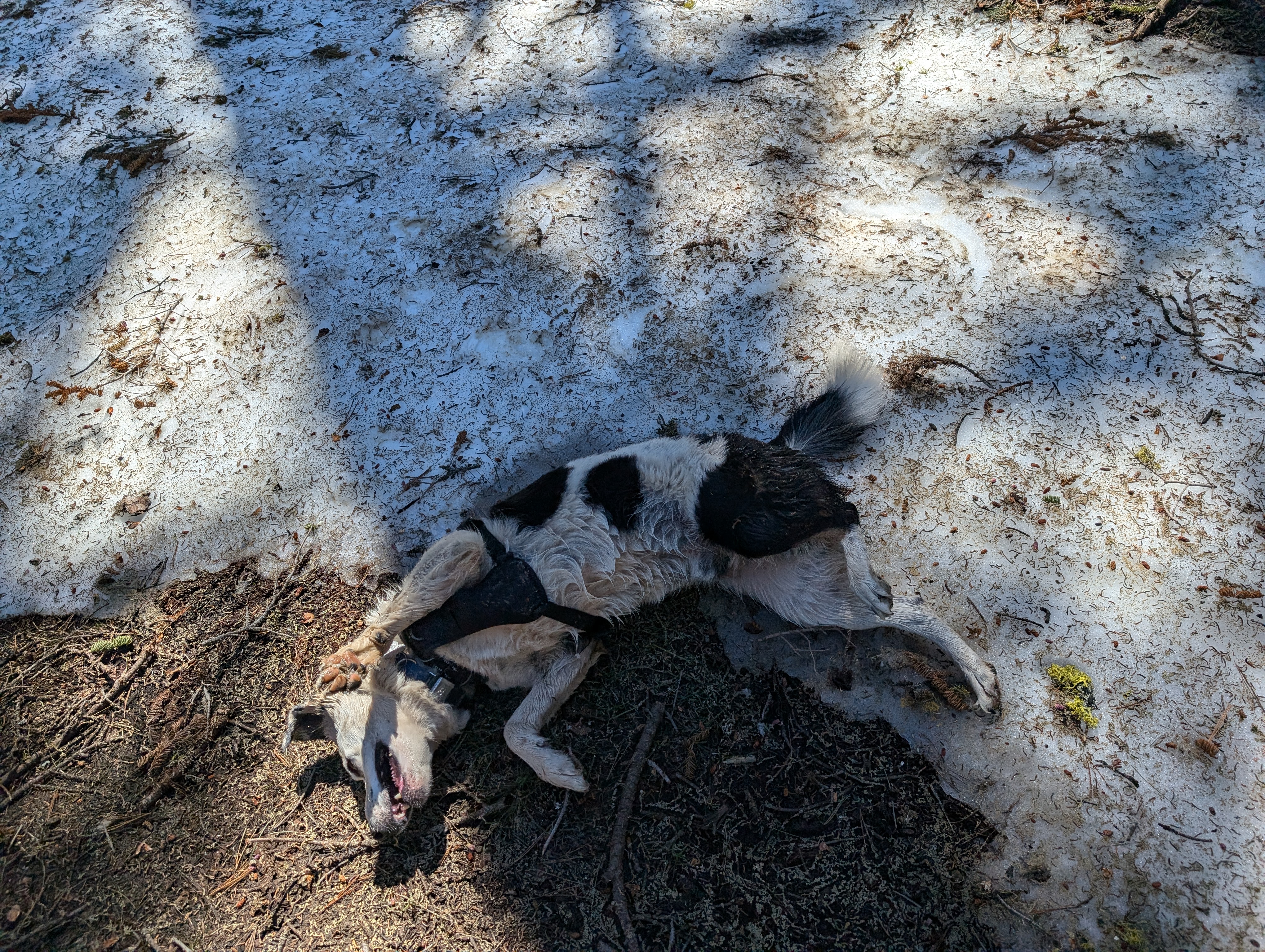 George cooling off in the snow
After a bit longer, we came to a fairly steep slope that would lead us to the west ridge. I asked my wife how she felt about it, and she had no issue going up, so up we went. The going was slow, but steady here. I stopped to pick up yet another Sierra Crest balloon, this one being of the “Happy Birthday” variety. Some kid in Chico probably lost that balloon a decade ago. I’ve lost count of how many of these I’ve found over the years.
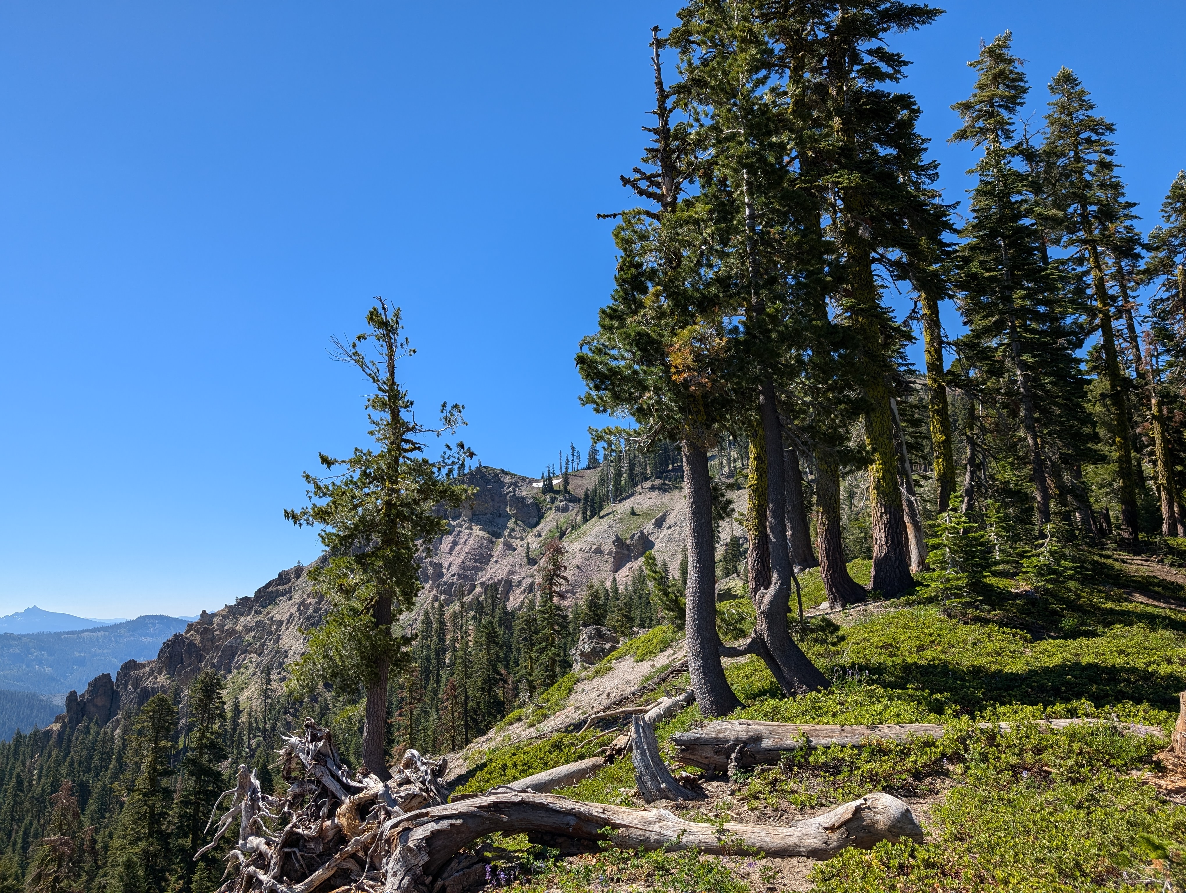
 Below the summit ridge
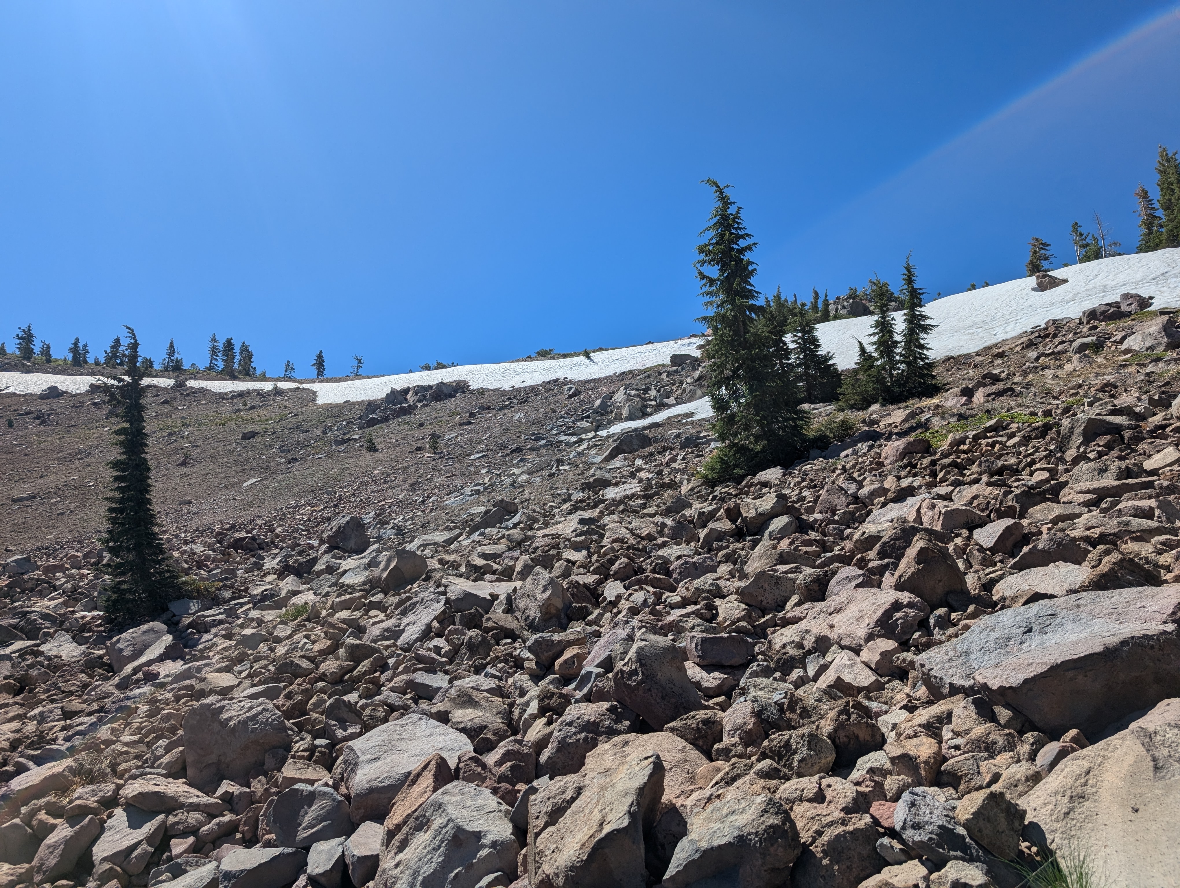
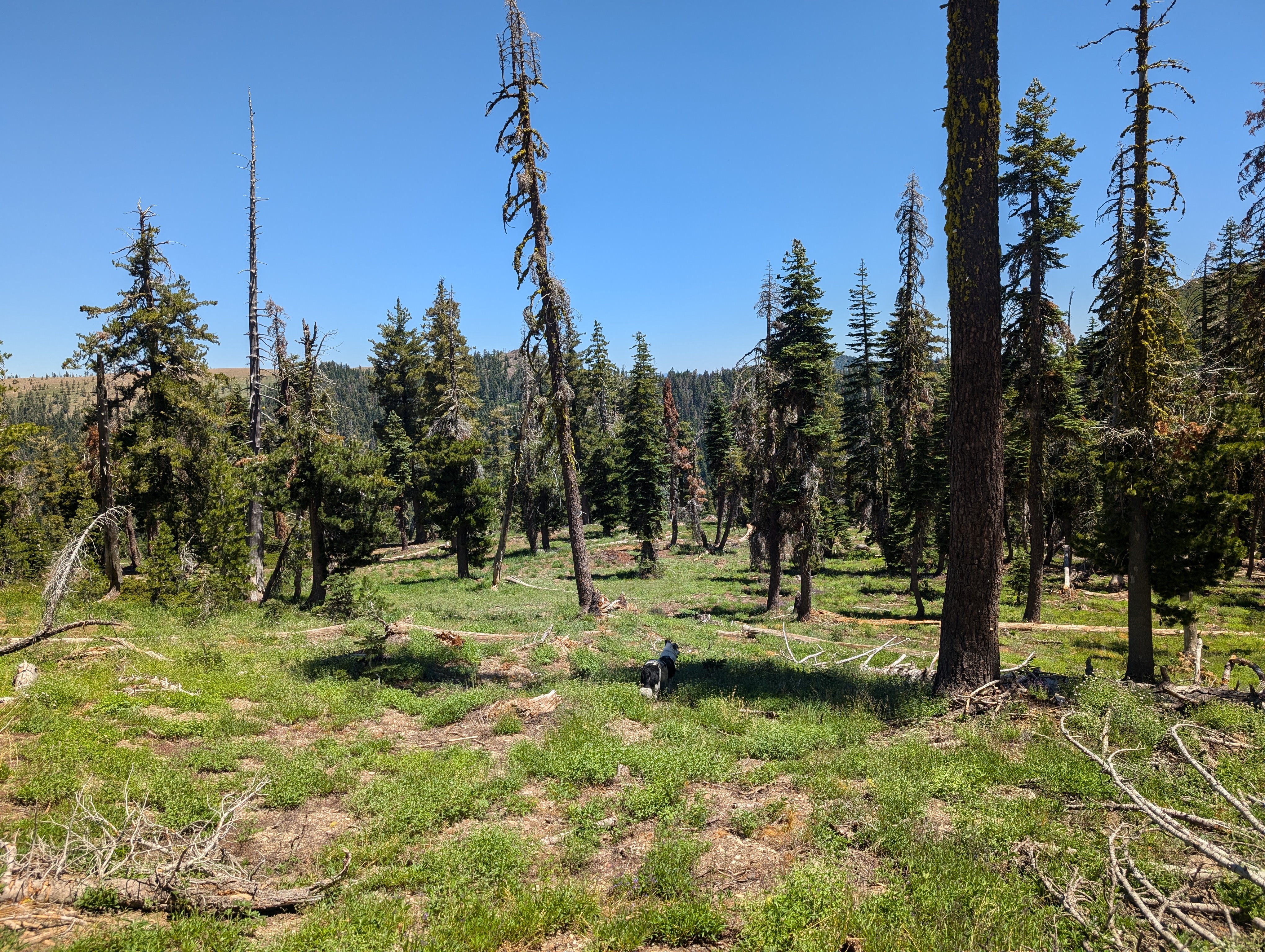
Once through the steepness, we just had one small rock field to cross, and we were on the ridge a few hundred feet below the summit. This section offered minimal resistance, although there was one dense Pine Copse we had to find our way around. Before long, we were at the summit of my 58th Ogul peak. The summit was definitely not the most aesthetically pleasing, its basically just an opening in the bushes. Despite that, the views were pretty nice, and I was glad to be here with my favorite human and animal. One nice bonus was seeing Lassen to the north, a rare sight from the Tahoe area. There was quite a bit of broken glass from what is apparently an old lookout, so I did my best to keep George away from it.
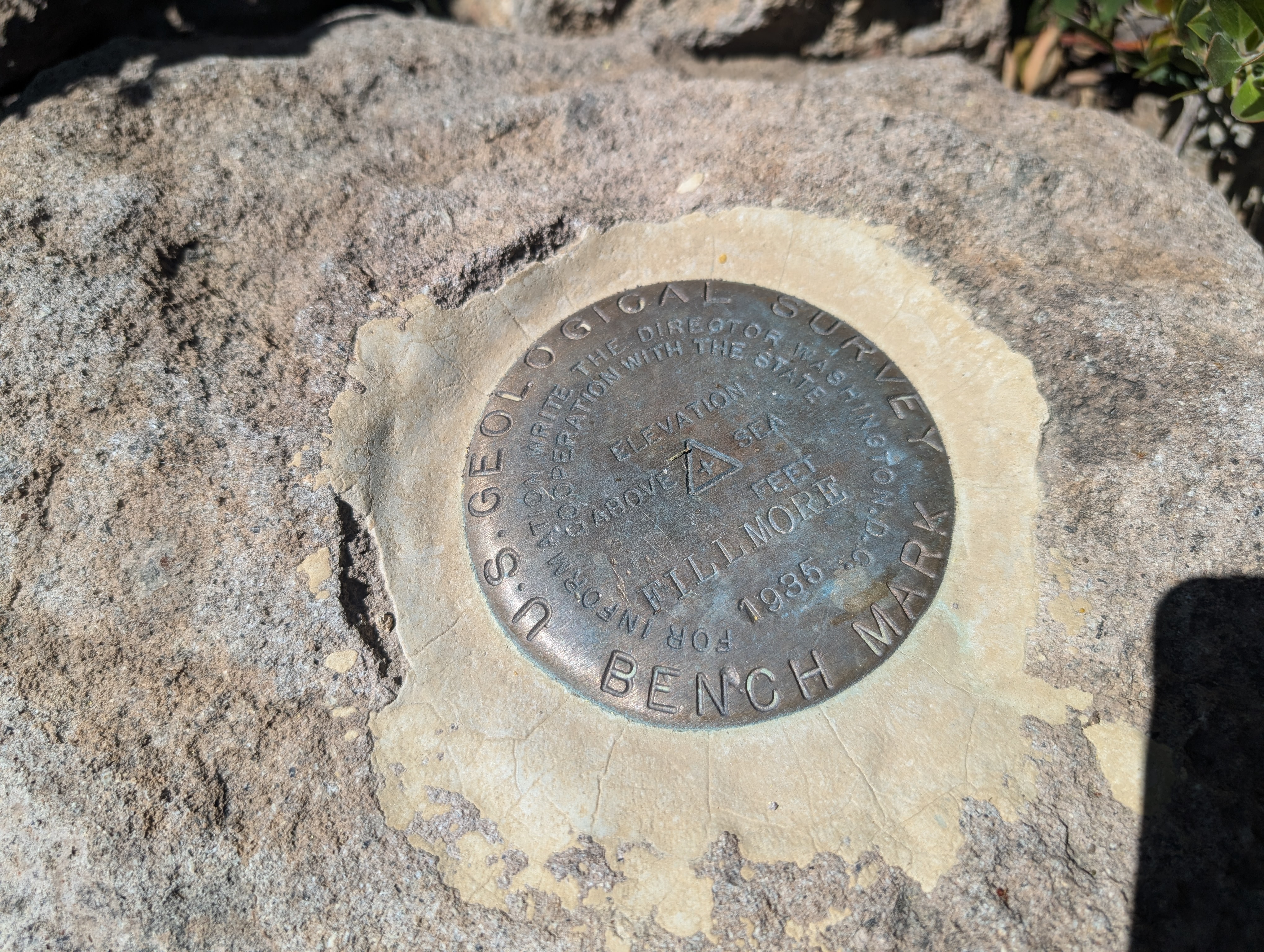 Mt Fillmore’s benchmark
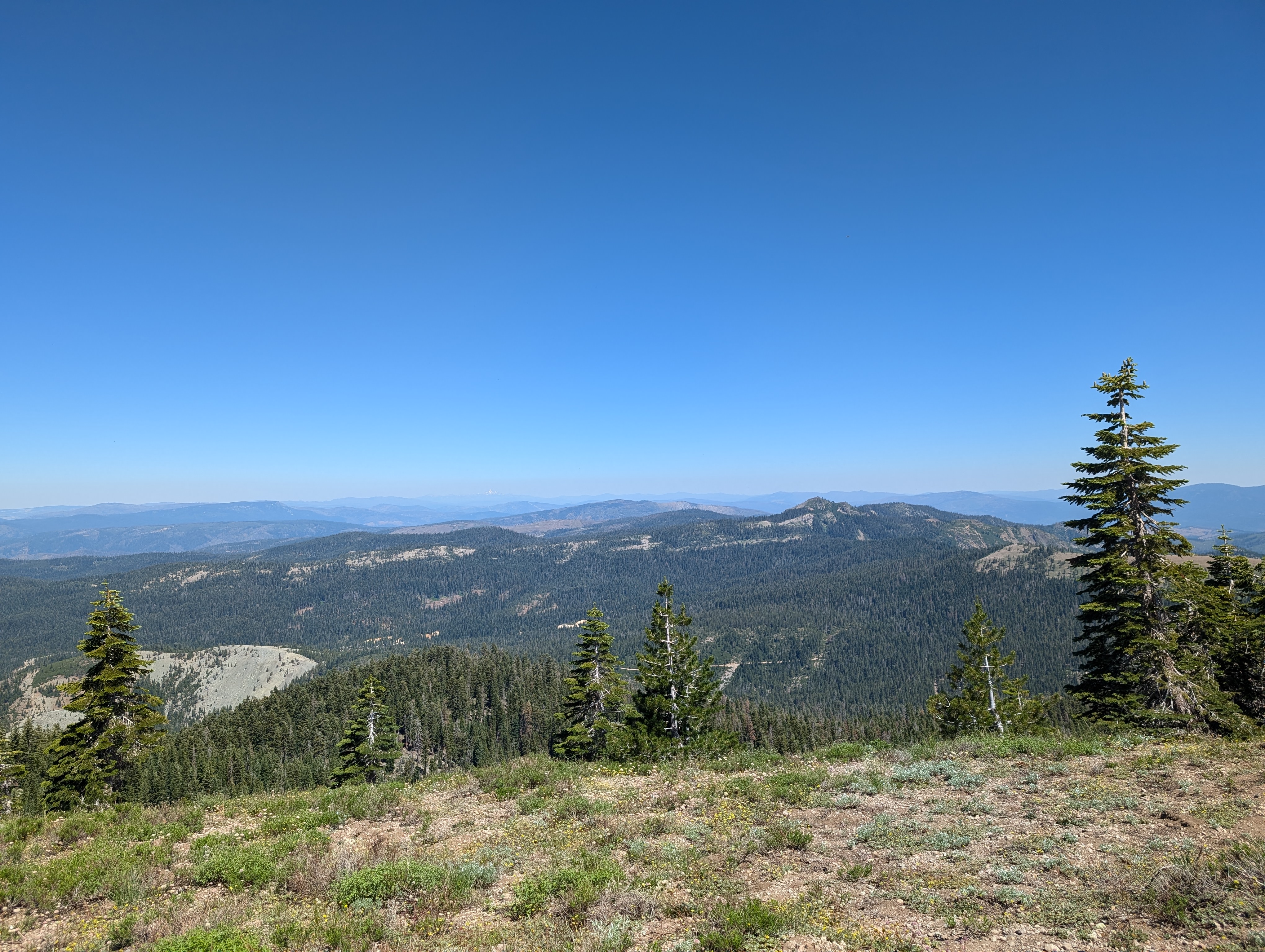 View looking north from the summit. Mt Lassen can faintly be seen left of center
We stopped a bit down from the summit for a break, as there was more shade down there. I had a bit of service, so tried to figure out why Google Maps had led us on such a rough road. I saw that the Quincy-La Porte road was paved to much closer, but Google strangely showed it as closed. I wasn’t 100% convinced, but also didn’t want to find that closure, and have to double back and make the rough ride even longer. I gave up on the idea, and we made our way back down the ridge. This time, we stuck on it for a bit longer, and had an easier time getting back down into the forest. Along the way, there was a large number of recently cut down trees, seemingly for no reason whatsoever. The trees were small, and had not been taken away from where they were cut. We then crossed the forest, and went back to the south ridge.
 A strange place to cut trees down
We followed the same route down the south ridge more or less, but did deviate to the east at one point, which made things harder than the way we came up. After a bit more walking, and another brief bushwhack, we were back at the forest service road, and then back to the truck. I was quite relieved to see all 4 tires still inflated, I had developed a tiny bit of anxiety about the drive in giving me a slow leak. At the trailhead, I saw 2 guys on quads, I stopped the second to ask about the Quincy-La Porte Road, but he was not local and had no idea which road he had taken in. We then buckled in for the long bumpy ride out, which was long, but not terrible with good company. We stopped in Greagle for lunch, and made the drive back home with surprisingly light traffic for the 4th of July.
 George leading a low bushwhack
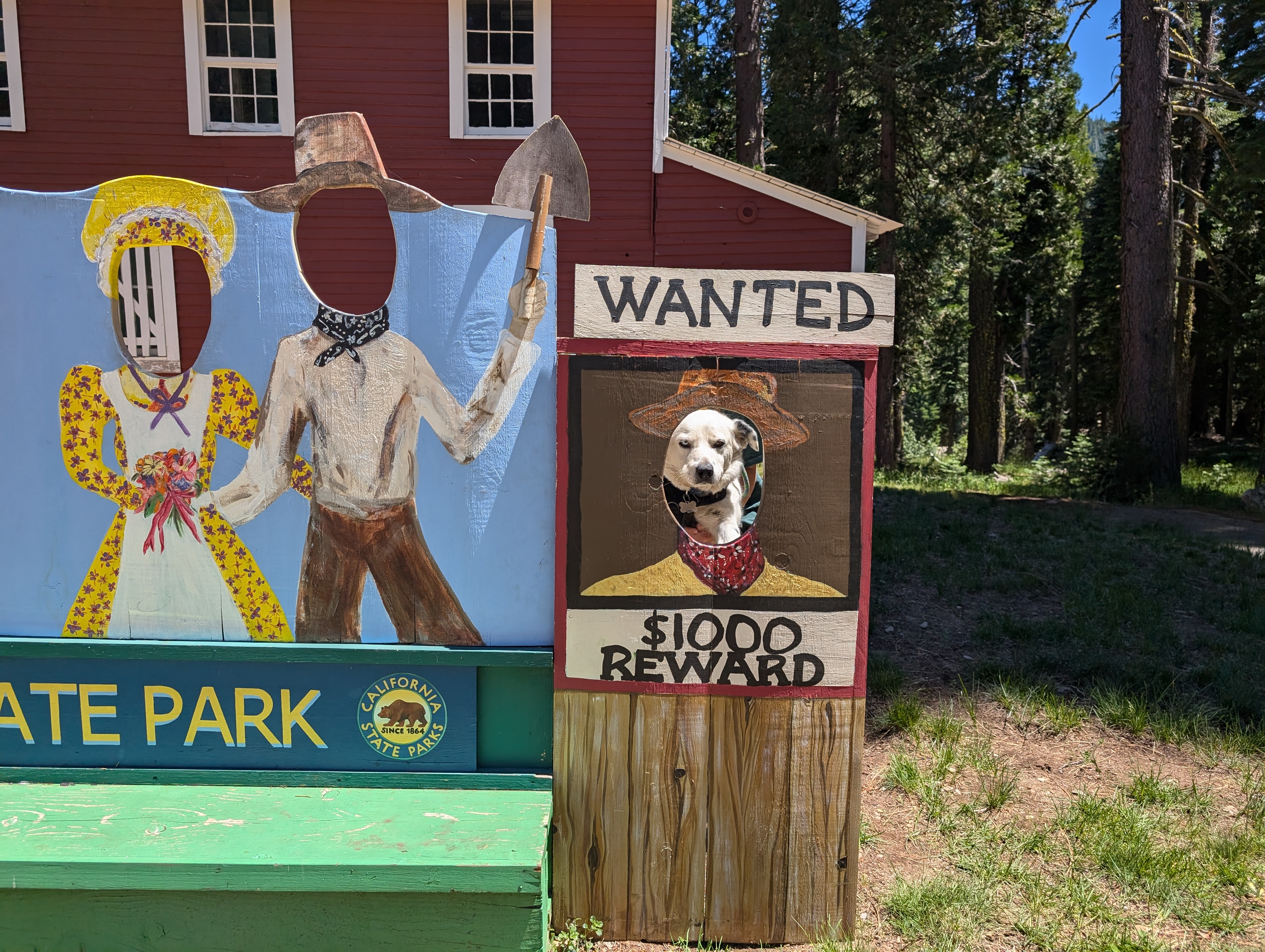 Plumas-Eureka State Park’s premiere photo op
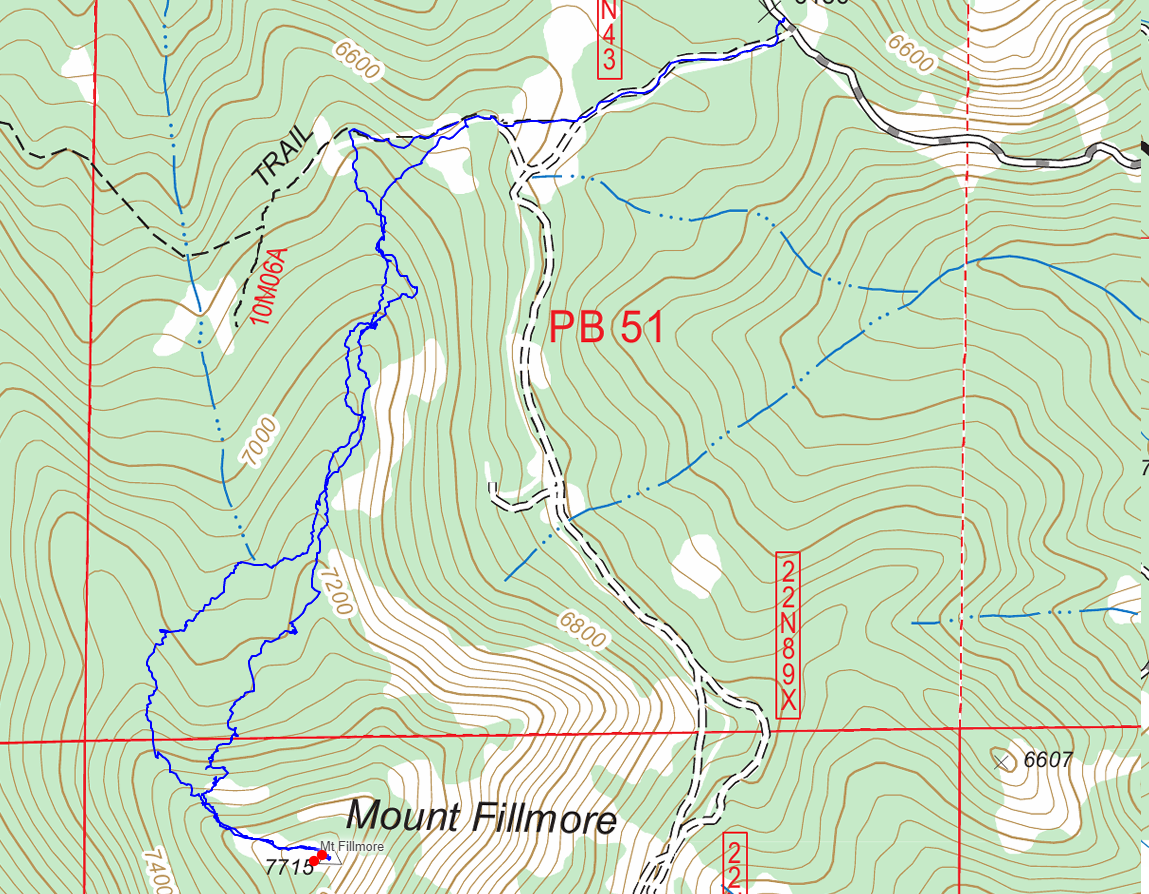
Route