April 27th, 2024
We originally had planned to do an overnight snow camping trip in Blackwood Canyon, and climb Ellis Peak. As the date got closer, I happened to stumble upon a forest service page mentioning that overnight camping was not allowed in that area, so the plan shifted towards a day trip. Chris and I met at his house at 5:30 and loaded into his Subaru. His dog, Cal would be joining us on the trip. We arrived at the Blackwood Canyon Sno Park around 8, and walked down the bike trail to a nearby road with a fire road easement leading into the forest service land. This allowed us to bypass crossing Blackwood Creek, which may have proven difficult with the spring melt happening.
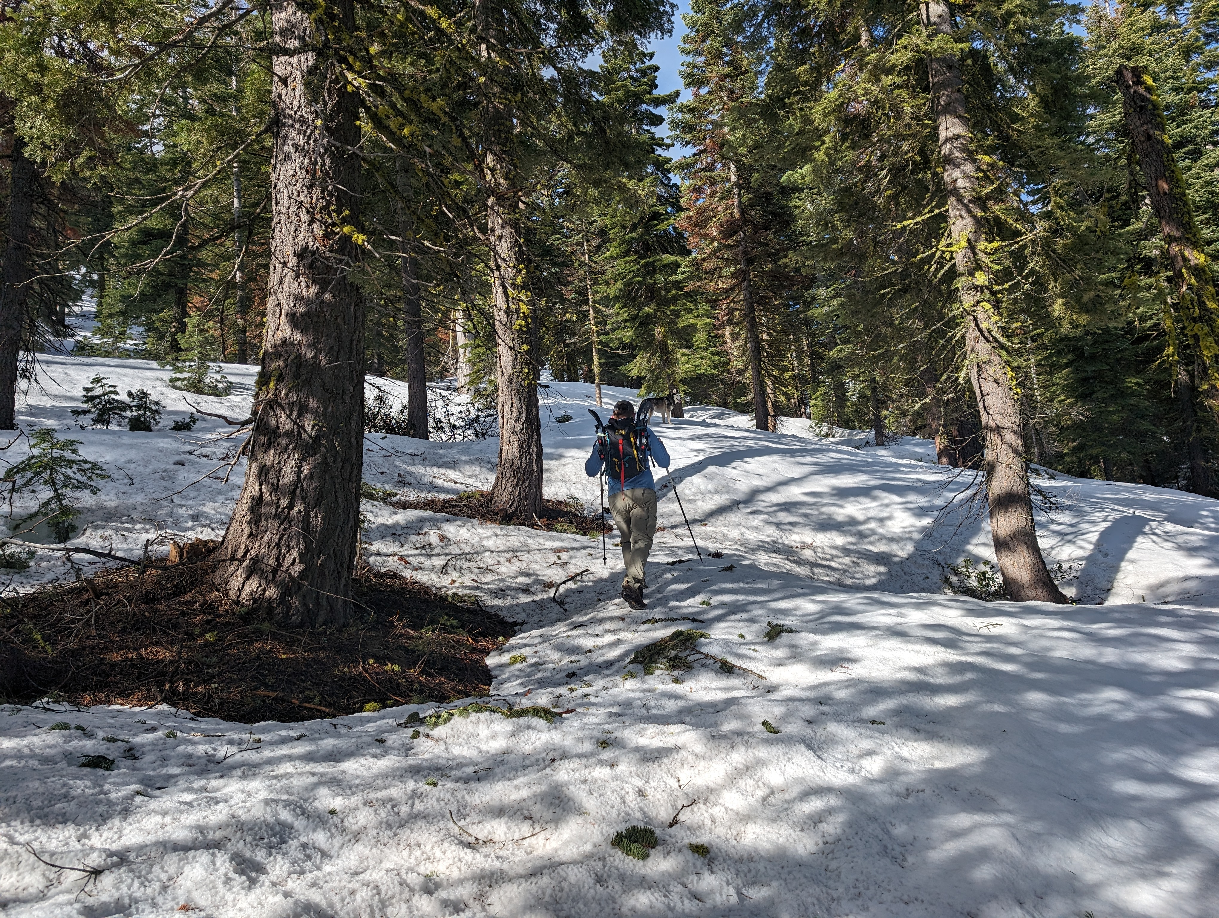 Chris and Cal near the trailhead
We walked a short distance up the road, and soon started directly up a steep slope towards the ridge. I had brought my splitboard this time, but just walked up this part in my tennis shoes as I didn’t quite feel like putting my boots on yet. The initial climb was pretty steep, but we made good time and soon were up on the ridge with a great view of Tahoe. Once we made it up there, I basked in the glory of the good route I had planned. This was going to be a good day.
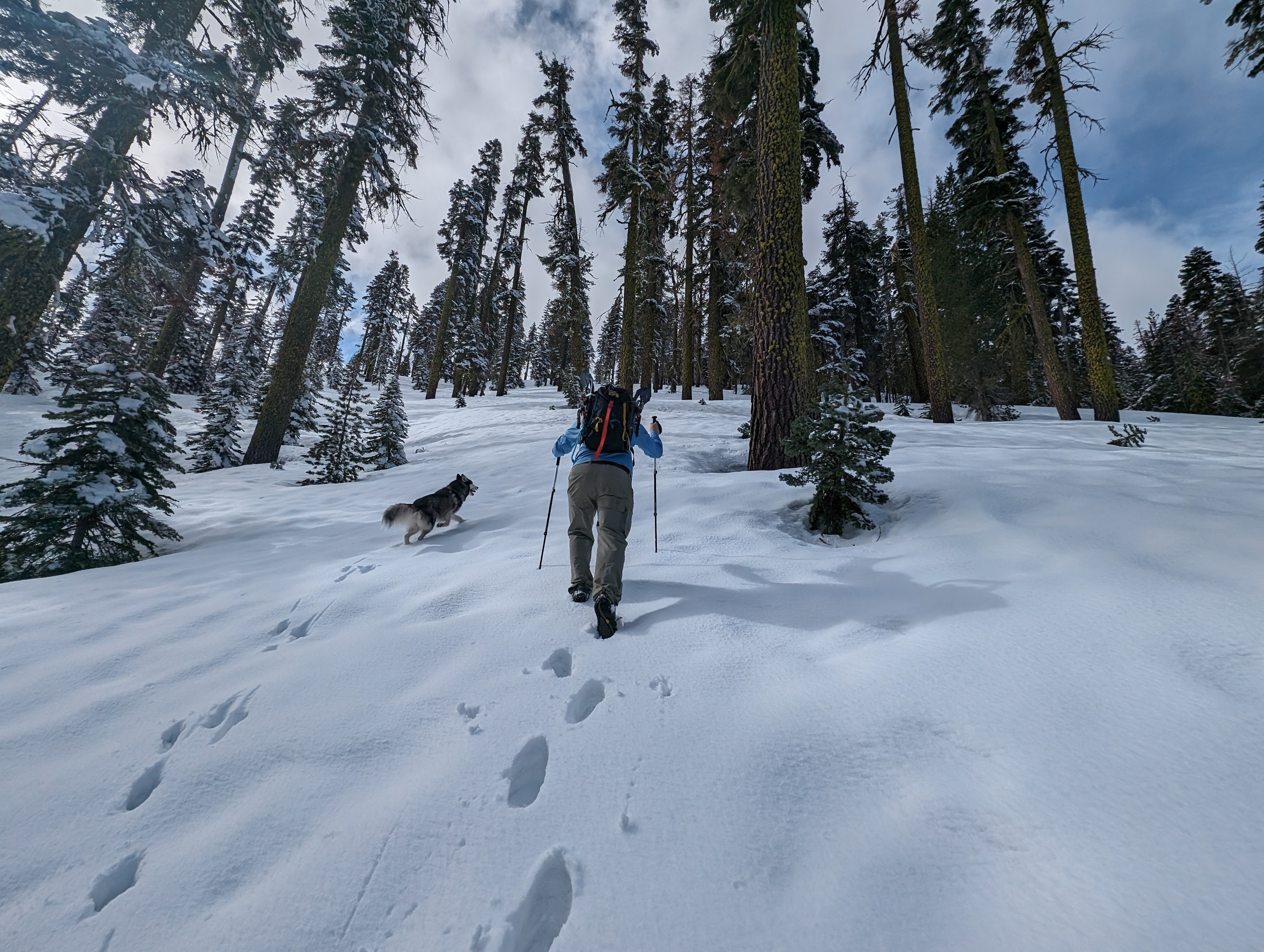 Heading up the steep canyon wall
I switched over to skinning, and we set off after a short break. The route was pretty moderate in steepness, so we enjoyed a nice casual pace as we went slowly up. The fresh snow from the past 2 days was around 6 inches deep or so, but getting baked in the sun. This made for some serious snow glopping on my skins. I stopped a few times to dry my skins out and add some wax to them. It helped a lot, but it still was taxing to carry around all that extra weight on my feet.
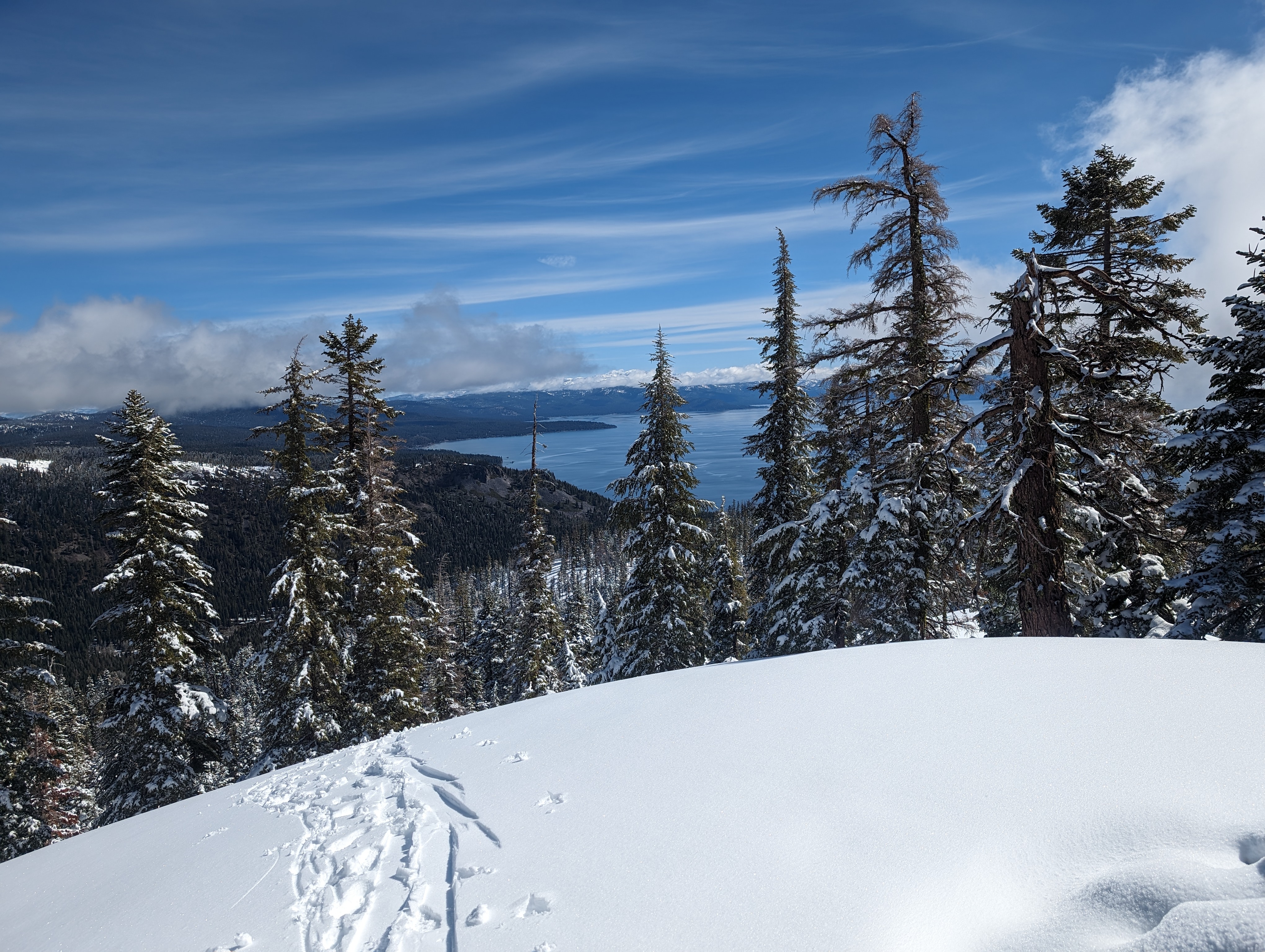 Looking back towards Tahoe
We reached the first bump in the ridge, and decided to go a bit south of the high point to avoid unnecessary elevation gain and loss. This worked out pretty well, and we soon came to a point where we could see the summit of Ellis. There was a decent sized cornice leading up this last section of the ridge ahead of us, so we opted to stay on the windward side, as there were some sections that had recently collapsed. Chris and I were both a bit worried about Cal, as he hadn’t had any water to drink that day. Chris tried his best to force Cal to drink some, but as the saying goes, “you can lead a horse to water…”.
 Ellis comes into view
The next section was a bit steeper, and the snow got a bit deeper as well. This made things a bit more taxing, but it became clear to me that we’d probably make it to the top, which powered me forward. After a bit longer, we came to the bottom of a false summit, both of us thinking the summit was right ahead. I asked Chris if he wanted to wait here with Cal, and we could take turns going to the summit, in case Cal was getting dehydrated. Chris agreed, and I continued up. Upon getting close to the false summit, I realized what it was, and checked my CalTopo app. It turned out we were still about a quarter mile from the proper summit. I called Chris to let him know, and he informed me that Cal had continued up to follow me after taking a short break, so they were both en route.
 Nearing the top of the corniced ridge
I finally got to the base of the summit block, and skinned my way up the last steep slope, and to the summit. The view up here was fantastic, probably one of the best views of Tahoe I’ve ever seen. You can basically see the entire shoreline, which isn’t possible from many places. About 5-10 minutes later, Chris and Cal crested the horizon, and we enjoyed a nice summit lunch as a group. The weather was perfect, and we were all in great spirits. I had a nice turkey sandwich, some chips, and a Liquid Death water, pretty dang good for the top of a mountain.
 Summit panorama
 Group summit selfie
I switched my splitboard back over to board mode, and told Chris I’d meet him at the bottom of the slope ahead of us (he was using snowshoes). I made a few turns down it, and was back to a flat section pretty quickly. Chris and Cal caught up, and I decided I’d just split ski the rest of it rather than make a bunch of transitions. This ended up being a great idea, as the skiing was more fun for me than snowboarding would have been. We made good time on the way down without too much fanfare. There were some patches of inconsistent temperature snow, which caused me to go over backwards on my skis once, but it was a pretty mellow crash. Before long, we were back at the top of the steep section we had climbed to gain the ridge. I was a bit apprehensive about skiing something this steep on my split skis, but started off pretty mellow, taking huge wide turns down the hill. By the time we made it to the bottom, I was making much smaller turns, and having an absolute blast skiing down with Cal running right behind me. Chris made pretty good time too, doing a hybrid of jogging and glissading down the mountain.
 Looking back at Ellis after skiing down
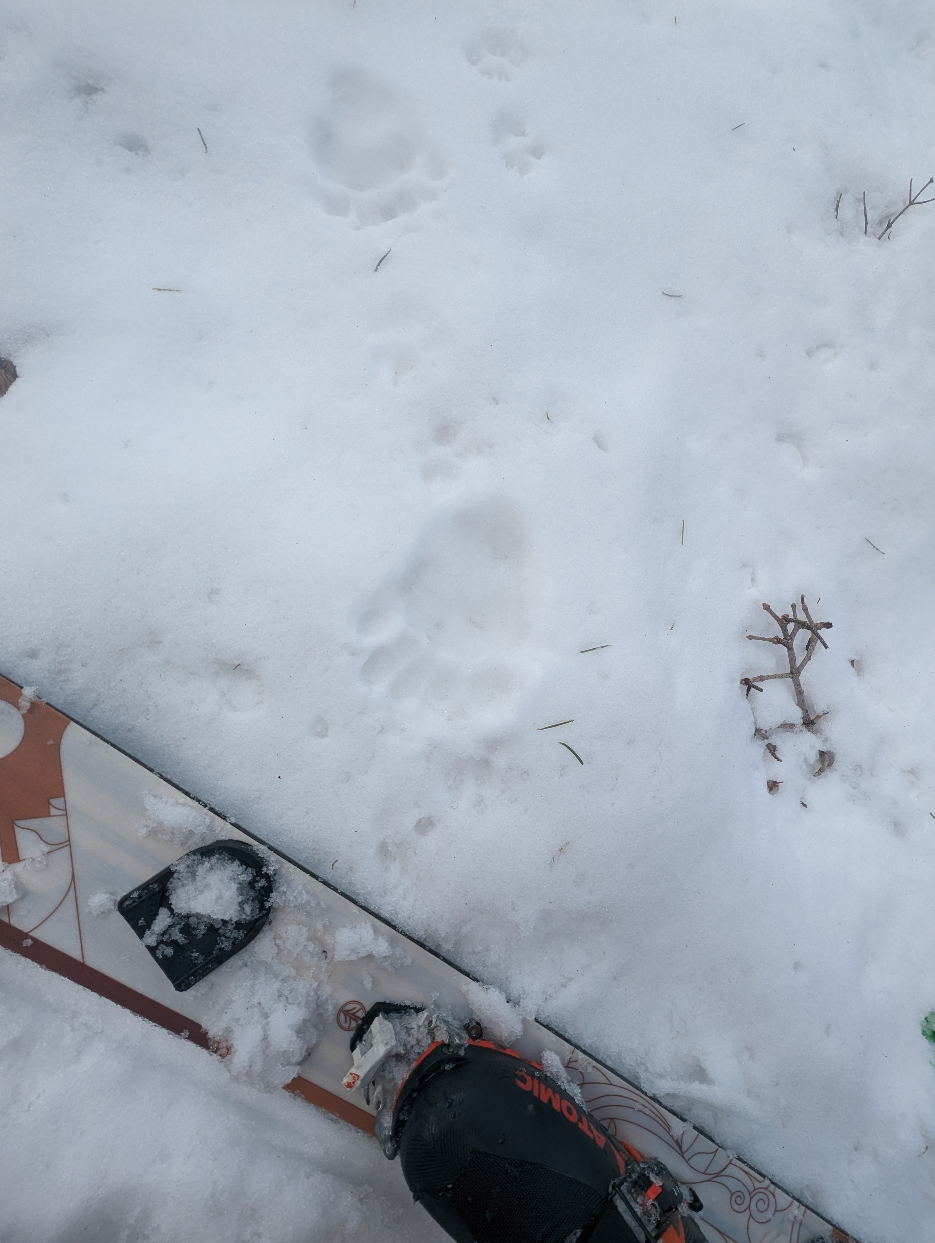 A small bear track close to the trailhead
In my excitement, I overshot the way we had come in by a bit, and we had to make a short backtrack to get to the fire road we came in on. Once at the start of the fire road, we opted to stash our gear there in an inconspicuous spot, and come grab it with the car. We made the ~1.5 mile walk back on the road, and came back to grab the gear. On the way back, we stopped off in Meyers for burritos, a tradition I’ve become quite fond of.
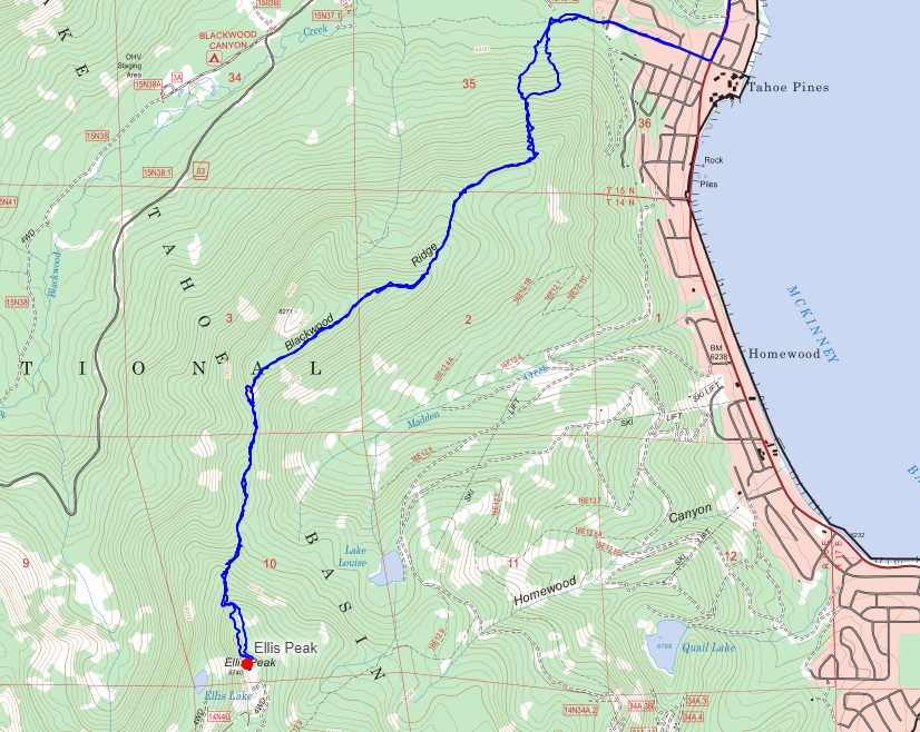
Route